By John Treadwell Dunbar ——Bio and Archives--January 7, 2011
Travel | CFP Comments | Reader Friendly | Subscribe | Email Us
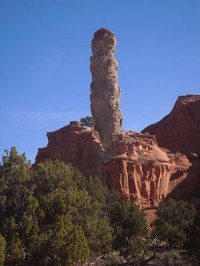 Rarely visited and off the beaten path, Kodachrome Basin State Park is a sumptuous buffet for the senses, an immovable feast hidden smack dab in the middle of nowhere far out on the edge of nothing.
You'll find it midway between lost and wild, up in the rugged high desert of southern Utah's Colorado Plateau on the northwest fringes of 2-million-acre Grand Staircase - Escalante National Monument.
If you're a crow, fly 30 miles southeast of Bryce Canyon National Park and stop when the pavement ends.
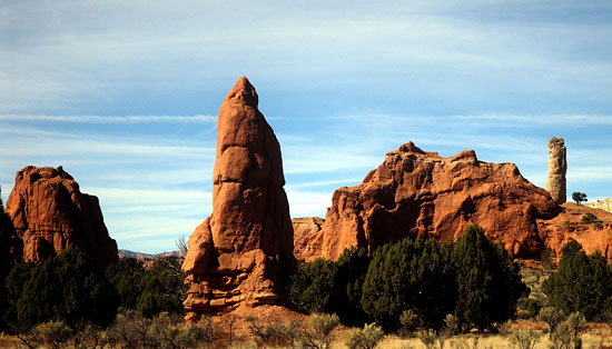
If you bring the kids to Kodachrome Park be sure to cover their eyes. Some of the monolithic spires known as sedimentary pipes that stand erect on the valley floor are downright obscene.
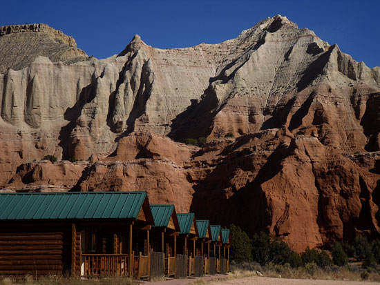 Like many others, I always found a convenient excuse for bypassing the 2,240 acre preserve. Off Highway 12 and nine miles south of tiny Cannonville - a speck of an old Mormon ranching community where lives are steady and the days calm – visiting Kodachrome always seemed like such a bother in light of the wonders of Bryce Canyon up on the plateau or the marvels of the Escalante region to the east. But I was running out of parks to chronicle, so this fall I committed to the long drive, exchanging the proletariat browns and grays of Bryce Valley for the vibrant pinks and reds of the Basin.
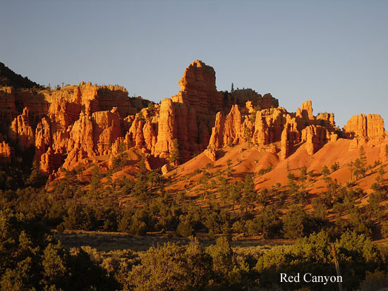
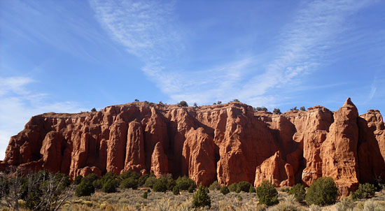 Most visitors approach Kodachrome from the west along State Highway 12 and are usually headed for Bryce Canyon National Park 20 miles east of the 89 junction. The road to Bryce traverses the Paunsaugunt Plateau and winds up through Red Canyon. Similar to Bryce Canyon with orange and red hoodoo stacks, and magical spires that burn crimson at sunset, the smaller treat at Red Canyon is still worth a stop and a hike.
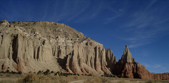 Granted, it gets crowded along the main highway where the campground is located, unfortunately, but you can escape the roar of traffic and car doors slamming and peals of laughter by setting out on foot for a short jaunt along the Photo, Pink Ledges or Tunnel Trails that meander through Ponderosa and Bristlecone pine. The higher you climb, the better the scenery. What's nice about Red Canyon and Casto Canyon farther on is that it's not in the park, but rather within 2-million-acre Dixie National Forest. Consequently, you're free to camp, hike, mountain bike, RV, ride your horse and go four-wheeling in ways otherwise prohibited at hyper-regulated, crowd-choked Bryce Canyon.
RV enthusiasts have been camping, or “boon-docking,” in suburban leisure on the plateau for years. They're tucked back in the forest, their plastic wheeled boxes parked in small meadows and hidden valleys. Come nightfall you'll see them roasting their weenies and knocking back highballs as they point their satellite dishes toward the southern skies in search of ESPN while their generators go VROOM through the wee hours of the night.
 Up here, dirt roads crisscross purple-sage country and spider web through expansive forests of ponderosa, mile after mile. Up here on the plateau is where you'll find long caravans of ATV off-roaders strung out single file in noisy procession, choking on vast plumes of brown dust, having a time.
A couple of years ago, a few miles from the park, we camped in this corner of the world. Lightning raked the black sky and thunder boomed and rumbled all night long. By morning we skedaddled for pavement before the inevitable deluge bogged us down on muddy back roads for a week. Under dark and ominous clouds we drove slowly along dilapidated fence lines, parked at the edge of a stock pond and watched a large black stump move to the left. It stopped, then moved left some more.
 I cut the engine and raised my binoculars in disbelief as a darkish-gray/black California Condor slowly took flight, lumbering, struggling it seemed, flapping wings that spanned seven feet like a small airplane, beating and flapping those mighty feathered flaps in rhythm and chugging over the ridge and away leaving us in awe with dawn's first light and raindrops plopping on the windshield. Lightning flashed. Bryce Canyon, it turns out, is Condor habitat and our sighting is regarded as highly unusual.
After the turnoff to the park the 12 plunges down the eastern escarpment, winding through pink and orange and beautiful sandstone pillars emblematic of Bryce Canyon to the south where you'll find millions of towering pillars and spires and hoodoos in red, orange and white configurations. Millions of them fill large amphitheaters strung out along a 20-mile-high, forested ridge with views into forever and beyond. This time I fought the temptation to visit heaven on earth and continued down and down the winding road to Tropic, past working ranches and black cattle and weathered barns dating to the turn of the century, and irrigated fields still green and splayed along the narrow valley floor. Hard right at Cannonville.
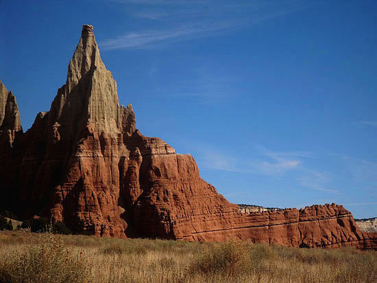
 Kodachrome Basin has a layered geologic past reaching back 180 million years to the Jurassic Period. The Carmel Formation left us with white stripes in red cliffs throughout lower elevations. Layered on top of that are beautiful reds that characterize so much of southern Utah, the Entrada Formation, fine-grained sandstone composites of clay, quartz, gypsum and shale. Above that are tan and white Henrieville Sandstone layers better seen at Grosvenor Arch 10 miles south of Kodachrome along a dirt road that can become treacherous in the rain (don't get stuck out there, and don't get lost!). And above these sandstone layers, Dakota and Tropic Shale Formations were deposited a mere 95 million years ago.
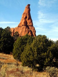
Of course the most striking features in the park and surrounding area are those 67 unique sedimentary pipes, some of which rise to a height of 170 feet. There's no consensus on precisely how they came into being. Earthquake-caused pathways might have filled with a sludge of sediments that cemented, became harder than the surrounding sandstone which eventually eroded away and left standing columns. Maybe the pipes are the remains of natural springs clogged with hardened sediments which were the last to fall to the eroding forces of nature's wind and rain. Whatever. The point is they're there and people are paying money to see them.
 A visit is definitely worth the small admission fee and the minor detour. The campground is passable and offers showers. Cabins will keep you out of the dirt and safe and sound at night. Two words of caution. Don't step on the titmice or the rattlesnakes, and watch the weather. Even though the park is open year-round, the best months are late April, May and June. And during the fall, September and October are prime visiting hours. Don't let the desert environment fool you. I've been caught in violent snowstorms up here in late April, and October will see the thermometer drop into the 20s. You'll roast in the summer as the needle tops 100 F. And during winter, as beautiful as it might be, be prepared to freeze to death. Oh, and forget about using your cell phone.
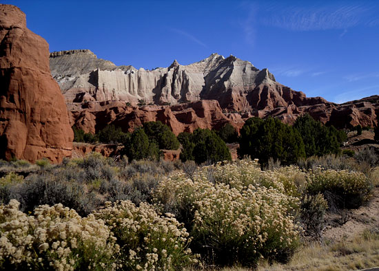 Kodachrome Basin State Park is aptly deserving of the name and all of the wonderful memories that Kodachrome film stock gave us over the decades. I can't say I'll miss waiting 2 weeks for my pictures to be developed, or paying through the nose for the pleasure. Just don't forget to bring your digital camera and extra batteries when you visit the park. And on your way out, don't forget to remove your hands from your kids' eyes.
View Comments
John Treadwell Dunbar is a freelance writer