
By Dr. Bruce Smith ——Bio and Archives--April 1, 2024
HeartlandLifestyles | CFP Comments | Reader Friendly | Subscribe | Email Us
This week week marks a new occasional column theme for my postings on Americas Free Press/Canada Free Press. A dear friend and confidant suggested that there be some attention given to the old ways of doing things, in order to pass them along to the next generation. It’s a terrific idea, and here’s the first installment.
Upon our return from a journey to New England recently, it being the first day of Spring, I paused to check my setting for due east. My arrangement isn’t exactly a scientific instrument, but it gets the job done for me. The two stainless screws in the top of the white post are oriented toward the spot on my horizon where the sun peeps above the horizon on March 21st and September 23rd. On those two days in the northern hemisphere, the sun rises exactly in the east. As the earth orbits around the sun, from March 22nd to September 22nd the sun rises north of due east. From September 24 to March 20th the sun rises south of due east. You can set your calendar by it. It’s uncanny.
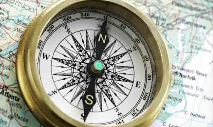
The directions on the compass rose have long been an interest of mine because I have farm ancestors. When I was still very small I remember my farm grandfather and my dad talking about storms coming in from the west. The Swindell place was east of my grandparents’ farm in Henry County. Town was north. Lewisville was south. Knightstown was southwest. As I rode in their car moving west toward the farm and the setting sun with my grandparents one afternoon, my grandmother pointed out how the crepuscular rays of the sun were drawing water through the broken clouds from the earth below. She passed that lore along to me in a magical moment I have never forgotten. The sun sets in the west.
Farm folk must know where east is for farming, gardening, setting trees, getting about, predicting the weather, building buildings, and a host of other reasons. Where the sun will play early in the morning is important for crops of all kinds. If there are trees about, it’s important that they don’t rob crops of needed sunlight with their shade. In the garden, we orient rows for drainage purposes but also for sunlight. Some crops like a bit of shade during the heat of the day but some can’t tolerate it. Corn and pole beans and sunflowers are tall. Carrots and spinach and bush beans are short. We try to plant them in the best places because we consider the points of the compass rose.
Knowing basic directions is crucial for understanding the weather. We live in a temperate zone in the Northern Hemisphere which features prevailing westerly winds. The Coriolis effect serves to deflect these prevailing winds a little to the northeast. Because of this, along the Old National Road in the Heartland, storms and weather systems spin in a counterclockwise direction and tend to approach from the southwest.
The Blizzard of 1978 and most of the big ol’ comma storms come at us from the southwest and move to the northeast. In the days before modern weather forecasting, a barometer and awareness of the wind direction was essential for knowing how worried to be at planting or harvest time. As a low pressure system approaches the winds come around to the southeast, south, and southwest, depending on the latitude of the low. Dangerous winter storms may begin with wind from the east. When a cold front passes the wind swings around to the west, northwest, or north. That change in wind direction signals the arrival of colder air behind the front. Even when a weak front passes without rain or storms, noticing that the wind is out of the northwest or north tells us we can expect cooler temperatures for a day or so. Predicting the arrival of rain and cool temperatures is very helpful in the garden and on the farm. Without a sense of directions on the compass rose, the changes would tell us very little. With that sense, we can see a map of the frontal system in our heads and predict many of its features. The directions indicated explain why we call that instrument atop barns a weathervane
A good way to check due north is to locate the North Star on a clear night. It’s as unerring as checking the position of due east with the sunrise on the equinoxes, but works every night when the stars are out. Polaris happens to always be located directly above our north pole. Without a general sense of where north is to start with, finding the North Star is challenging for the naked eye. The front edge of the pan of Ursa Major, the Big Dipper, points to it. On very clear nights the North Star is the end of the handle on Ursa Minor, the Little Dipper.
Support Canada Free Press
North has always been a mystical direction for me. It’s the direction from which we receive much of our cold air and snowstorms here in the Heartland. It’s where we find our hardy Canadian cousins. There’s the remarkable ballad by Johnny Horton titled North To Alaska.
They crossed the majestic mountains and found the bonanza gold
Below that old white mountain just a little southeast of Nome.
North is the place of autumn’s fall color splendor. The North Star guided escaped slaves across the Ohio River to freedom in the North and, better yet, in Canada. My ancestors served the Northern cause in our Civil War, even though they were from a slave state in the South. In the past when we’ve needed true friends and allies, we have found them in abundance in the True North, in Canada.
These days I live on a crooked road at the end of a crooked lane. When I first walked up to the front door of our house I thought it must face directly south. I was wrong. It faces southwest. Not long after we landed here I constructed the due east indicator you see in the photo. It’s the reference point in the opening paragraph of this column. When I eventually get the weathervane placed atop the garage, the north-south line will not be parallel with the roof ridge. Until then, I have a crude instrument atop the post. I check it against the point of the sunrise every equinox.

Call me a goofy geography nut, but it’s an emotional experience to fly over the Old Northwest Territory and points west where I can look down at the grid. It was Jefferson’s idea. The lands acquired by the United States after independence and after the land ordinances of the confederation government were surveyed according to an act of congress. The idea was to make the ownership of land easy and certain. The survey followed base points of reference north, south, east, and west in order to make the locations of property lines systematic, creating a grid of established lines.
These lines created a series of sections of land of 640 acres each measuring one mile on each of the four sides. From the air in much of the Heartland and westward into the plains, the grid is now marked by roads known as section roads within each township, within each county, within each state. Today the section roads indicate plots of land of 640 acres each. It’s one of the most magnificent achievements of mankind, and we have it right here in the Heartland. It’s a monument to property rights and enlightenment thinking. When I’m driving down those section roads on the ground looking at a county road map, I can picture what it looks like from the air. Jefferson gave us that map. I am always moved by the sight of section roads spread across the former wilderness.

So yes, I’m a geography nut. I’m proud of the fact that I had the GPS deleted from my phone. It’s true that I get lost now and then, but it’s my own fault. When I get lost I know what to do about it besides cursing my phone. I rarely get lost on the same route twice. I learn my way around by following major routes then gradually taking side routes away from the major ones. I keep my bearings by referencing the points I know. With a pretty good sense of direction most days, I don’t go astray for long. I pay better attention. I notice where I’m going. I’m way less dependent on quirky equipment to know which way to go. And I see things along the way better, like the hemlock woods in Pennsylvania and the Amish corncrib in Ohio. I don’t have to keep looking at the little screen so I can spend more time appreciating the real world. I get lost now and then, but not often and not for long. I like that.
For many years I’ve taken a road atlas with me practically everywhere I traveled. I’ve been able to locate my position above the Mississippi River north of New Orleans from the river bends showing on the pages of the atlas. I’ve used it to establish that my view was looking over the grid in Illinois, over Lake Mead in Nevada, and across Oneida Lake in New York. I guided the bus driver one dark night near Sidney, Montana when her GPS failed. The driver asked me how I knew the roads since I didn’t live there. I told her I had an atlas. I guided another bus driver across the Verrazano Narrows Bridge and through Brooklyn and northward because he had only vague directions and I had my atlas. Come to a detour for construction? Find a better one with the atlas. I’ve used road atlases and highway maps to teach practical geography skills. The same close friend and confidante who suggested this column navigated the way through a confusing interstate system in Atlanta before she was nine. She has had a good sense of where she’s going and where she came from ever since.
All of this awareness and appreciation of the landscape starts with a reference point and the compass rose. Check it twice a year on the equinoxes or on a clear night. If you’re going most anywhere, don’t forget to pack a good atlas. That’s old school.
View Comments
Dr. Bruce Smith (Inkwell, Hearth and Plow) is a retired professor of history and a lifelong observer of politics and world events. He holds degrees from Indiana University and the University of Notre Dame. In addition to writing, he works as a caretaker and handyman. His non-fiction book The War Comes to Plum Street, about daily life in the 1930s and during World War II, may be ordered from Indiana University Press.